Pages

Monday 16 June 2014

The Lost World


With the recent defeat on the Mount Anne Circuit still fresh in our minds Pete, Tim and I were keen to get out and acquit ourselves by conquering another trail. Tim, as our Tasmanian guide, had recommended Mount Wellington which looms over Hobart and is only a short walk from his house. Our ears perked up as he told us about a little-known hike up to a place called the Lost World which Tim was interested to explore.

So the next morning we kitted out with an ample supply of snacks and water and set out on foot along the road towards Mount Wellington. It was a stunning day, the sun was hot and there was barely a hint of cloud to be seen. In fact, it was hard to believe that not more than 24 hours ago we had been snowed-in on a mountain side and facing a serious possibility of hypothermia. That was definitely not going to be a problem today.

We passed the Cascade Brewery along our route and Tim explained that a large portion of the surrounding rain forest behind the brewery was privately owned by them but they maintained it for public use. I pondered this new information as we walked, and my thoughts went something like this: If Cascade supports forest conservation with the profits they make from selling beer, then when I drink Cascade beer I am supporting forest conservation. Forest conservation is saving the world and therefore when I drink beer I am saving the world. This seemed like very sound logic to me and it made me very happy indeed. In fact, I swore right then and there that I would do my bit to support this worthy cause that very night.

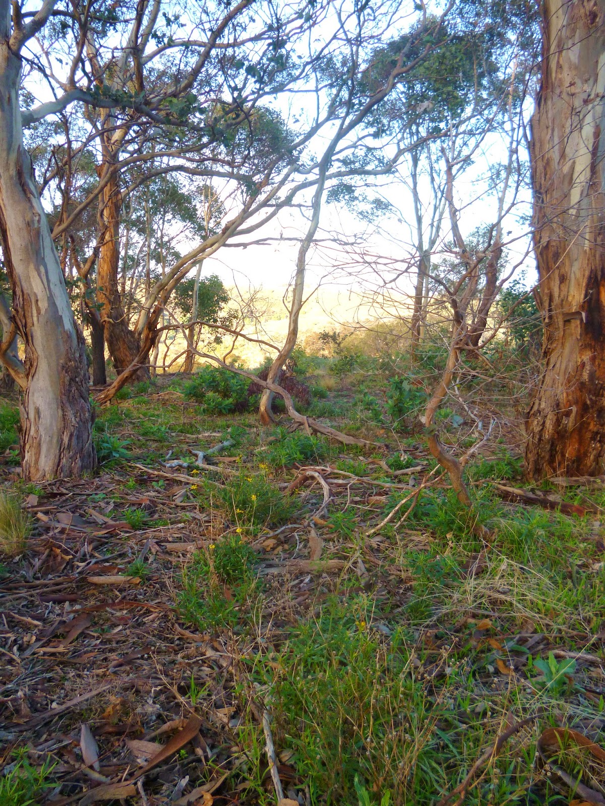
The initial track began in a cool rain forest with the characteristic flora of moss and ferns. The grade was quite steep but the good conversation made it easy work.


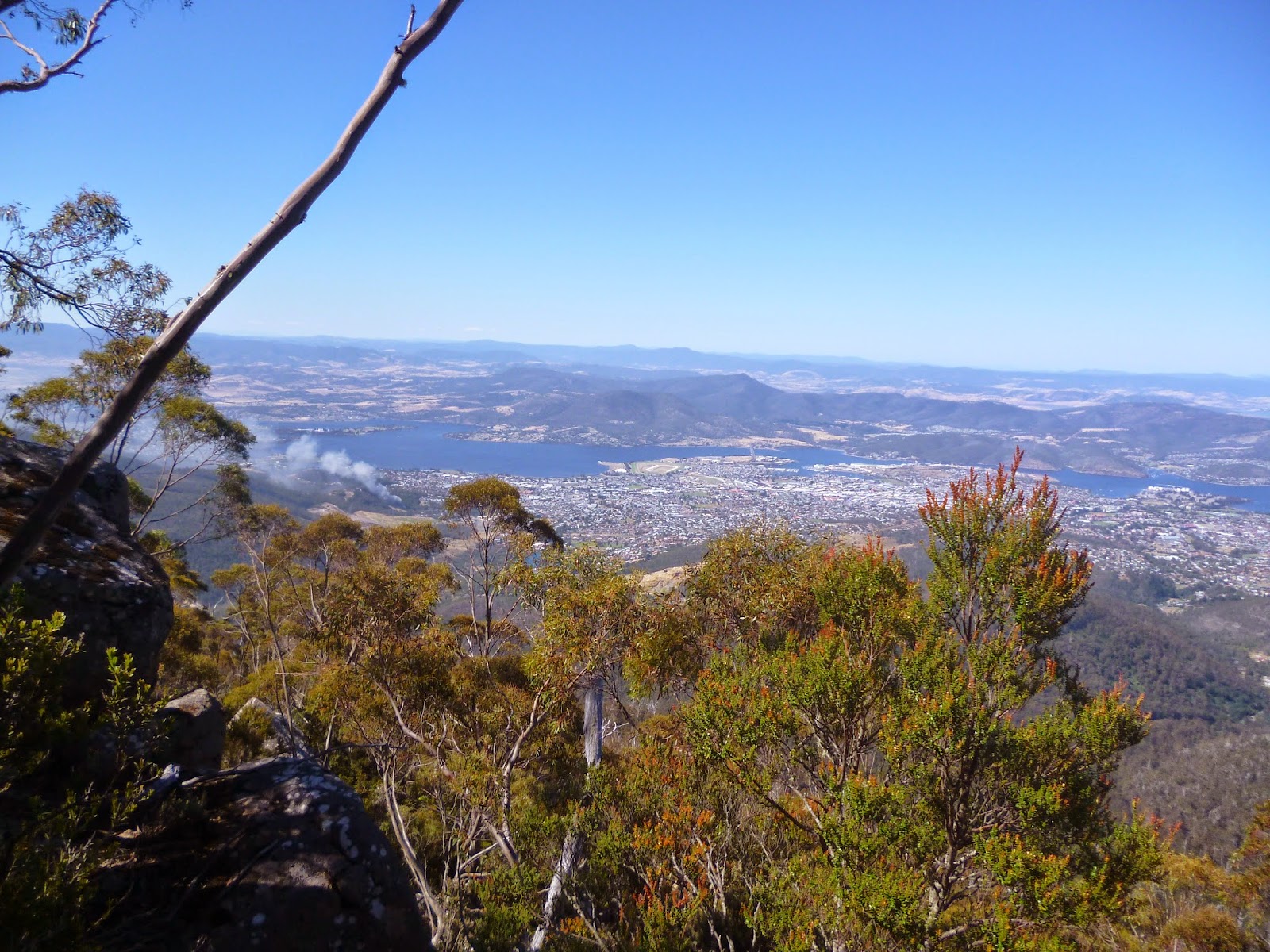
After a while, the trail opened out into very different and dryer terrain dotted with smaller eucalypts . It was also becoming quite warm. At times we could now glimpse a view of Hobart and the great Derwent river below us.


As we rose higher the path disappeared into a fields of boulders, the way marked only by occasional orange direction markers or sometimes rock cairns. It wasn't difficult to navigate but required a lot more concentration when choosing footing. I was actually glad to leave the well-worn path behind because only then do I really begin to feel that I am truly in nature.


We re-joined the trail further on and passed two other hikers, middle-aged gentlemen sporting large cameras and large waists. We stopped for a short chat and they told us they were heading for the historic cabin that we had passed a good 40-minutes earlier. They were under the impression they would find it imminently and none of us had the heart to disillusion them. They continued on their merry way no doubt eagerly expecting to to find the cabin around the very next turn. 

Not long after this encounter we veered off on another track which Tim believed would take us in the direction of the Lost World. It soon brought us to a small waterfall with a trickle of water running down. It looked so inviting we just had to climb it! 


The surface of the rock was treacherously slippery in places so we ascended cautiously. At least I did, it looked rather like Pete somehow fell up the waterfall in a series of rather terrifying and gravity-defying accidents but somehow he made it alive. 


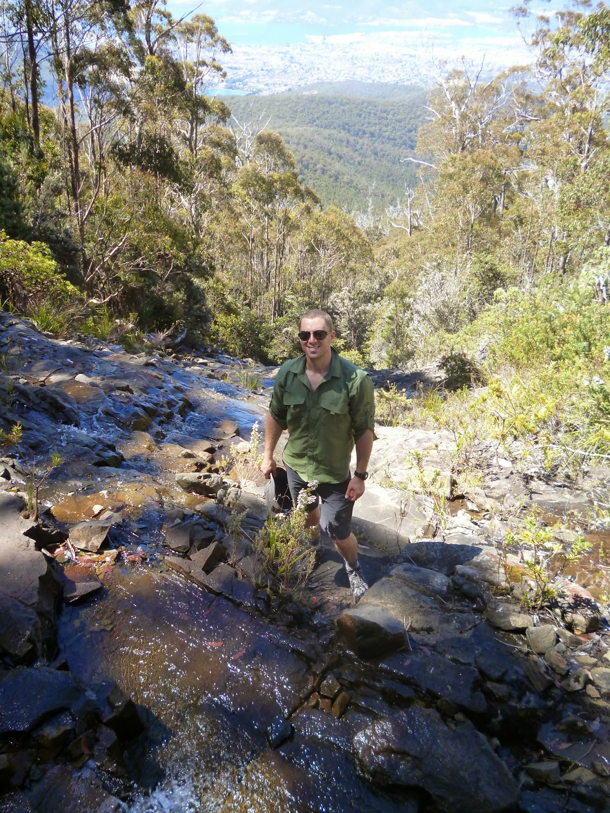
The view was beautiful and the water was cold and refreshing to splash on our faces. After a short rest there we made our way back down the waterfall to the path only to find that the path appeared to dead-end at the waterfall.  There was no obvious way forward. 


We searched around, clambering over fallen limbs and boulders until we stumbled upon a faded, palm-sized, red and yellow dot painted on a rock. Another identical mark was visible on a boulder further on and so we were sure that these marked the intended route, though it looked like no one had been that way for quite some time.  


Clambering over boulders and logs we edged our way forward, our eyes peeled for the painted marks. This part of the trek was a lot of fun as we climbed our way up the side of the mountain on what looked like a giant mound of boulders stacked one on top of another. 


Along the side of the track we discovered the entrance to a cave. There were signs that either animals or people used it as there was a worn appearance to the ground outside. The opening was narrow and steep and the inside was pitch black so it was impossible to know how deep it was. We were all reluctant to venture in but curiosity got the better of me and with Tim holding on to my ankles I slid in head-first to take a look.


Even as my eyes adjusted slowly to the dim interior it was still too dark to make out any hand or footholds so Tim handed me the camera to take some photos with the flash on. In the brief flashes from the camera I could see that there was a sharp drop of about 5-6 feet in front of me with the cave continuing on down at an angle until it was beyond view. I clearly couldn't go any further with only my head to break my fall so I gracefully wriggled my way arse-up out of the cave. Reviewing the photos on the camera as we walked on we discussed the possibility of returning one day, better equipped to explore how far this cave went. 


During one of our many brief pauses to take in the view, a fast growing plume of smoke was spotted in the valley below. Earlier we had discussed the potential for bushfire and our contingency plan in that event. But now we were far from the beaten track with no easy means of escape.  As we continued up we discussed our fire safety plan which at this point involved clambering down one of the deep crevasses between the boulders and hoping our oxygen wouldn't run out. Fortunately the fire was a long way off but we kept a wary eye on it.


The trail continued steeply ascending Mount Wellington until we came up over the edge of a boulder to find ourselves on a sort of plateau beneath a semi-circle of sheer cliff. We had found the Lost World!


For some reason I didn't take many photos in the Lost World, maybe it’s for the best, because the photos don’t do it justice. Perhaps it was also because I was so busy watching my footing. The entire area consisted of 
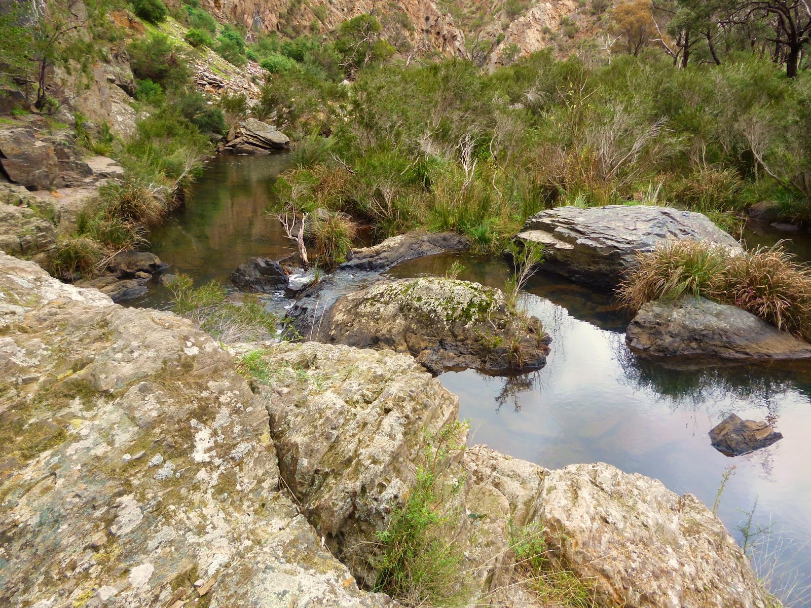
fallen boulders of gargantuan size with some truly spectacular chasms between them. One chasm I peered into appeared 20 meters deep and had ferns growing in its depths. It was quite magical really, as if you could imagine a whole miniature fairy kingdom living down there. 


Although we searched everywhere, there was no marking of the trail to be found and we were beginning to think the only way out was to scale the sheer cliffs. We headed off in different directions to explore our options. Tim and Pete went ahead, and I responded to the call of nature and went off to find a decent toilet spot. There was to be no burying of anything up here because it was all rock and so I was forced care of business in the only suitable place available. I am not sure the residents of the fairy kingdom would have appreciated my choice very much and I imagined their joyful singing abruptly replaced by cries of horror and pleas of "Won't someone please think of the children?!". Fanciful you may think, but such is the effect of being in the Lost World.


By now, Pete and Tim were out of sight and I began the arduous process of navigating a route across the giant boulders and around the chasms. I saw Pete ahead as he made an enormous leap between two boulders and figured I would head in that direction. When I got there I realised it was at least a three meter gap to the other boulder with a 15 meter drop straight down.  It would require a running jump with no room for error. Frankly, it was fortunate I had taken the time to relieve myself earlier because otherwise the prospect of this jump could have resulting in an involuntary process. I decided against the running jump as an unnecessary risk and began to think Pete led a charmed existence. I concluded that Pete must be part mountain goat - by all appearances looking like he will fall on his head but is actually as sure-footed a creature as you can find.


At this juncture, Tim called out from a distance to announce that he had found the way ahead. Towards the far right side the cliff became a more graduated slope and there were clear signs of wear and tear indicating that this was the way up. 


There were some great views of the Hobart area as we made the final climb up and out of the Lost World. At the top, we met the winding road that leads to the summit of Mount Wellington and although close to the top, the rest of the way up was on bitumen and it was bloody hot. Tim’s lovely wife Jane was going to be meeting us at the top with the car, so that we didn't need to make the return journey. It really was a hike to remember.

As I trudged that last kilometer, once again my mind turned to the subject of forest conservation and the thought that soon I'd be doing my bit to save the world, one beer at a time.

Wednesday 11 June 2014

A day-hike in Werribee Gorge

The weather was forecast for rain and my hiking buddies had bailed on me with lame excuses like the need to look after a sick family and such. So it looked like I would be heading off in a raincoat for a solo exploration of Werribee Gorge.

Werribee Gorge State Park is located in Bacchus Marsh about 70km west of Melbourne along the aptly named Western Freeway. According to the Park Notes the gorge has retained a rugged natural beauty and contains a range of walks varying in length and difficulty. The route I had determined to take was the Circuit which is approximately 10km in length and winds itself around the park and through the gorge. The grade is rated as medium to hard and I wanted a bit of a challenge.

I arrived at around 8:30am and parked in the Quarry Picnic Area. mine was the only car there, though I had seen one other at the first carpark. The sun was out but dark clouds loomed threateningly overhead so I decided to get cracking.

At first I couldn't find the track, which wasn't a great start. I had earlier reassured my wife that it was impossible to get lost in this park but now I had visions of a headline reading: "Lost hiker found in fetal position just metres from trailhead.". 

Fortunately I was able to retain my cool and find the path.

The beginning of the Circuit trail
The trail begins uphill and is mostly a wide dirt path that becomes rocky as it proceeds. The forest is sparse as you head towards the Western Viewpoint but it has the quintessential bleak charm of the Australian bush.


Instead of rain, the clouds dissipated and gave way to clear skies. The morning sun lit up the landscape highlighting and contrasting the scenery.


Because the forest obscured any distant views, my attention was drawn to the finer details of my immediate surroundings, the bright green moss, the regrowth, the bleached-white standing deadwood, and the curious succulent plant peeking through the dead leaves.


Although I hadn't come across any other people, I could still hear the occasional sound of cars on the freeway at this point which detracted from the otherwise remote feel of the experience.


The views from Western Viewpoint were fairly uninspiring, consisting of rolling hills, a farmhouse, and a distant view of the freeway. It did amuse me that the sign denoting "Western Viewpoint 100 meters" was barely 50 meters away. Not much further along is Eastern Viewpoint which in my opinion was much more beautiful and more amusingly only about 15 meters from the 100 meter sign.


Eastern Viewpoint, Werribee Gorge
I was walking slowly, taking my time and stopping to smell the roses. Not literally of course as there were no roses in sight and I had neglected to bring my own supply (Note to self: bring roses).

I continued my meandering along to the next point of interest which I think is a highlight of the Circuit. The track leads up to a high-point at the crag of a cliff that affords a wonderful vantage point of the Blackwood Pool.

Blackwood Pool, Werribee Gorge
By this stage the sun was warm, I was feeling peckish, and I had a spectacular view so I stopped for a cup of tea and a snack. I used my little homemade alcohol stove to boil up a billy of tea and sat down on the edge of the overhang to sip my brew. It was the very definition of serenity sitting there, hearing only the sound of the river and the birds, watching a duck swimming in the pool below, and the ripples of fish nibbling at the surface. After sitting and drinking in the view for a while it occurred to me that as I tarried, other noisy people might catch up to me and spoil the experience, so I packed up and moved off.


From this point the track led steadily down into the gorge until it was more or less level with the river. The track also became less distinct and more like a bush trail.


The water was mirror-like and reflected the sky, grass, and rocky sides of the gorge.


       A wildflower growing down a rock face
By now the trail involved sections of rock scrambling, which were not particularly challenging in the current dry conditions but if it was wet or if there had been recent heavy rainfall, I could see how sections would quickly become impassable due to rising waters and slippery surfaces.


The different types of rock lining the ground and cliffs were constantly varied and colourful making for interesting scenery in such a closed in landscape.


This is the Lionhead Beach. Apparently if you look closely you can make out a lions face in the cliff face of the lower right-hand side. I would also say, that if you look closely for long enough, it is more likely that your eyeball will dry out than you will actually see a lion's face. This is not recommended.


Rounding the bend, the path ends and some steel cable anchored to the rock wall mark the way forward. To be honest, the steel cable would have made navigating this section about as fun as a 40km speed limit. Very safe, but not very fun. So I didn't use the cable and went across like people probably have for the last few hundred years, holding on to the rock itself.


After navigating around the rock face, the track quickly moves into a section called the Aqueduct walk. Apparently an industrious farmer back in the early 1900's decided to build a water race along the gorge to irrigate a hundred acres of farmland. The current track is supported by the remains of this concrete wall which makes for a very practical track but in my humble opinion detracts from the wilderness experience.

There was interesting spot along the opposite side of the river that appeared to have been man-made. The picture below shows is of a section about 15-20 metres up a steep cliff, just below a cave-like area, where it looks like a piece of wood has been laid out to cross a gap and then been built up with slabs of rock. There was no obvious path or way up to this spot but I wondered whether it had been constructed to allow access to the cave. I was determined to come back and get a better look another time.


Now the path had become wide enough for an obese and legally blind hipster to trundle along whilst staring intently at their smart phone without coming a cropper. So of course I ran into a small group of aspiring environmentalists, some of whom closely resembled the description of the aforesaid hipster. They giggled inanely as I passed. Apparently it is hilarious when someone says hello to you. I should probably have tweeted or bookfaced my greeting or something.


Now with the hipsters safely behind me. I powered on. Eventually I came to a fork in the road. It wasn't a metaphoric fork in the road causing me to experience a personal crisis about my direction in life, but rather a literal fork in the road. I could either follow the Short Circuit walk to the left, or continue on what I assumed would be the so-called Werribee Gorge Circuit walk. I could not have been more wrong.

I came to Meikles Point carpark where a young guy approached me asking feverishly whether I had recently passed a group of young people. It turned out he was supposed to be with the group but had arrived late. I showed him where I had seen them on my map. It was quite straight forward but he seemed to be struggling with the concept of a map that did not involve GPS and voice commands. I gave him my map and he ran off in search of them. I hope he survived.

I walked on and couldn't find the trail. It seemed to just become a field with no discernible track at all.


After walking around in the field for a while, which was quite pleasant if not very useful, I stumbled upon what looked like a four-wheel-drive track in the general direction I wanted to be going. It led up a steep hill for quite a way until I saw a trail marker ahead. I'm still not sure what track this was. It did lead back to the Quarry Picnic area but it was neither picturesque or interesting which begged the question, why would you put a track here?


The Werribee Gorge was a great day-hike and only a stones throw from Melbourne. I completed the trail in around 3-hours and was back at home again in an hour. It's definitely somewhere I will go back to and explore in more detail. I'd like to check out the rock climbing at Falcon's Lookout and see the Blackwood Pool up close. Even though it's only a small State Park the Werribee Gorge has serene and wild places that let the hiker escape into the wilderness without the travel time. 

Wednesday 4 June 2014

Hammocks for Hiking


Hammock from Ticket To The Moon

One essential item of hiking equipment is shelter. Most hikers use tents, which are versatile because they come in a variety of sizes to accommodate an individual or whole families. They can also be both compact and relatively lightweight depending on how much you're willing to spend. However, the downside is that every tent requires a flat piece of ground to pitch on. I love to hike off the beaten track in rocky, steep and heavily forested areas, so finding a suitable campsite can be frustratingly difficult.

Hammocks defeat the need for meticulous campsite preparation. They can be slung up just about anywhere, they are quick to put up and take down, they are minimal impact on the environment, and they can be very lightweight indeed. There are a vast range of options out there to suit the even the most fussy sleeper. I like the Outdoor Gear Lab reviews and tips on choosing a hammock. 

But perhaps what I like best of all is that you can make a hammock yourself! Like most lightweight enthusiasts, making your own gear on the cheap is one of the great enjoyments of hiking. I found this blog To The Woods very informative on the topic and have resolved to try my hand at making my own hiking hammock.


I’ll post a further update when I’ve made some progress!

What do you think about hammocks for hiking?